Thursday, December 25, 2008

Christmas trip to New Orleans LA


Our plan WAS to go to New Orleans for the Christmas – New Year holiday week. We reserved our plane tickets way back in September, using our remaining frequent flier miles that we earned when we were flying around the world fairly regularly. We reserved our hotel rooms at the Frenchman in the French Quarter back in October. We had a great itinerary all worked out:

Dec 25 – fly from Las Vegas to New Orleans in the afternoon.
Dec 26 – Explore the French Quarter, including the Cathedral, and then go over to Algiers Point to see Mardi Gras World.
Dec 27 – Explore the Warehouse District and check out a bunch of the cool museums there, like the Confederate Museum.
Dec 28 – Explore the Garden District in the morning (we had lunch reservations at Commander’s Palace) and then the Museum of Art in the afternoon (they had a traveling exhibit of the Impressionists.)
Dec 29 – We had a rental car reserved so we could drive out to see several old plantations and their mansions, including the plantation where the Uncle Remus stories were documented.
Dec 30 – Finish up the French Quarter, including the neat old above-ground cemetery and the Historic Voodoo Museum.
Dec 31 – Do some shopping in the French Quarter in the morning and fly back to Las Vegas in the evening, and spend New Years Eve in Las Vegas.

So, we got all packed up and ready to go on the 24th. On Christmas morning, after we chatted with Colin Jr. in Bulgaria, had breakfast, opened presents, and cleaned up a bit, we loaded up the car and headed toward the airport in Las Vegas to catch our plane to New Orleans. As we were backing out of the driveway I noticed that the battery and brake lights came on in the dashboard of the car – that was troubling – but I knew that we’d recently replaced the entire brake system (front and back) and that the battery was pretty new (maybe one year old, at most) and the car seemed to be running just fine, so we headed off anyway. There was a little voice inside my head telling me to switch over to the 4-Runner, but it wasn’t topped off with gasoline, so I decided to head off anyway. As we drove down the freeway the car seemed to handle OK, but I kept thinking through who I could call on my cell phone if we were actually to break down. Just as we passed the last exit to Mesquite several other lights came on my dashboard and I decided that we were in trouble. The next exit from the freeway was about ten miles away and I was hoping that we’d make it so I could drive back at least to Mesquite, but we didn’t. Just a mile or two short of the exit, the car completely quit and I coasted to a stop off the shoulder of the freeway, right between several hills where we couldn’t get any cell phone service. I got out and looked under the hood of the car, hoping to find a loose battery cable or something, but didn’t find anything out of place. So we got back in the car and Leslie offered a little prayer. Then I was able to start the car and we made it to the next freeway exit; I drove under the freeway and headed back towards Mesquite, but the car didn’t make it onto the freeway – we were dead dead dead – I looked under the hood again, but there was still nothing obviously wrong. Fortunately we had cellphone service at this second location and I was able to phone a friend from work who lives in Littlefield, Arizona, just twenty miles or so back up the freeway. He offered to come get us and we accepted. So we played with our new Christmas game, Catchphrase, and amused ourselves until he arrived. He brought a large pickup truck, with room for all of us to ride inside, and a flatbed trailer big enough to carry our dead car. Then he drove us back home to St. George, where I dropped off Les and the girls, and then we took the car to the shop to leave it for the next business day (that day still being Christmas.) I called American Airlines and they told me that all the flights to New Orleans were booked solid for the next few days, so then we called and canceled our hotel, rental car, and restaurant reservations and then we unpacked our bags. Sigh. Maybe we can make New Orleans at Spring Break.

Friday, December 12, 2008

Why Guns? A Refresher


I fear that the writing is on the wall and we are past the day when having a gun is purely for sport. I honestly never expected this day to come in my lifetime. I hope I’m mistaken about the signs of the times - I guess time will tell. In the meantime, here is a brief refresher course about why America MUST have an armed populace:

FIREARMS REFRESHER COURSE

1. An armed man is a citizen. An unarmed man is a subject.
2. A gun in the hand is better than a cop on the phone.
3. Colt: The original point and click interface.
4. Gun control is not about guns; it's about control.
5. If guns are outlawed, can we use swords?
6. If guns cause crime, then pencils cause misspelling.
7. Free men do not ask permission to bear arms.
8. If you don't know your rights, you don't have any.
9. Those who trade liberty for security will have neither. --Ben Franklin
10. The United States Constitution (c)1791. All Rights Reserved.
11. What part of "shall not be infringed" do you not understand?
12. The Second Amendment is for when the politicians ignore the others.
13. 164,999,987 firearms owners killed no one yesterday.
14. Guns only have two enemies; rust and politicians.
15. Know guns, know peace, know safety. No guns, no peace, no safety.
16. You don't shoot to kill; you shoot to stay alive.
17. 911: Government sponsored Dial-a-Prayer.
18. Assault is a behavior, not a device.
19. Criminals love gun control; it makes their job easier and safer.
20. If guns cause crime, then matches cause arson.
21. Only a government that is afraid of its citizens tries to control them.
22. Only corrupt government is afraid of its citizens.
23. You have only the rights you are willing to fight for.
24. Try enforcing the laws we ALREADY have; don't make more gun control.
24. When you remove the people's right to bear arms, you create slaves.
26. The American Revolution would never have happened with gun control.
27. Austria wouldn't be a free state with gun control.
28. Israel would not exist with gun control.
29. "To enslave a nation you must first confiscate their firearms." --Adolph Hitler, circa 1936
30. "Those who hammer their guns into plows will plow for those who do not." --Thomas Jefferson

The photo is of my 15-year-old daughter Kat, practicing her pistol marksmanship at Thanksgiving. You'll appreciate that she's already knocked down two of the silhouette targets with her six shooter.

Saturday, November 15, 2008

Ruins and Petroglyphs


Today (Saturday, November 15) Leslie and I went with Robert and Palma (and Locke and Carol Sue and Stan and Tammy and Larry and his grandson) and we went four wheeling over on the other side of the Coral Pink Sand Dunes. First Robert took us to this private ranch (he had permission and a key to the gate) and we drove and then hiked in to these neat old Anasazi ruins with a bunch of petroglyphs. (I’ve attached a photo of Leslie and me in front of one of the little cliff dwellings.) The four wheeling was a little precarious in spots, as we drove sideways along a sharp incline along the edge of a canyon, with Leslie and me both leaning uphill as hard as we could. Some of the spots were bad enough that Les (and the other wives) got off the back of the four wheelers and just walked. Then we went over to the other end of the dunes to see some cool petroglyphs that Stan and Tammy knew about – they were really neat but they were sure an extended drive to get to. Even so, the company was great, the weather was perfect, the four wheeling was fun, and no one wrecked or hurt themselves – so it was a successful outing.

Monday, November 03, 2008

The U.S. to become the next Bolivia

From my perspective, as a power engineer, there will be no winner tomorrow [in the Presidential Elections], only losers. Both candidates have attacked the whole energy industry, which I take personally after devoting 20+ years to providing affordable and reliable electricity to thousands of consumers here in the US and hundreds of thousands in developing nations overseas. So for me the two candidates are "bad" and "worse" - there is no "good." Just today I heard from my wholesale power supplier that back in January Obama promised "skyrocketing" power bills and "bankrupt" power companies - that was a shocker (see: http://www.youtube.com/watch?v=08FgJP-RCGs) - I don't see ANY winners in that scenario. I just see us becoming the next Bolivia or Bangladesh. Well, I guess I'm as qualified as anyone to function in that future - I've already worked there. But it still makes me very very sad.

Saturday, October 25, 2008

Our Kids and Public Schools

After reading this thoughtful exchange on our children's education [on another forum], I think the bottom line is that we all be reminded that it's absolutely essential that we, as parents, stay involved in our children's education. That's equally important whether they're home schooled or attend public, charter, or private schools. So much of the kids' problem at public school these days is that the parents don't stay involved (or worse, that they're totally absent.)

Whatever your choice for educating your own children, we cannot afford to forget that universal education is the only way that universal suffrage can function in a democratic republic. Our republic can't survive if we have an ignorant and uneducated electorate (as witnessed by our recent and current elections.) And currently, our public schools are the only option for universal education, so they must be maintained, however much effort that requires of us. I spent ten years (1997-2006) working and living with my family in developing countries, and saw first hand the price of ignorance and the failure of those countries to thrive due to their lack of universal education. I fear that we're moving in that direction right here in the U.S.

I feel very fortunate to be blessed to be living and working here in sheltered St. George, Utah, where most of the public school teachers are nice Christian moms, including my own wife. I don't have any problems with what my kids' public school teachers have taught my kids (except when they ignorantly try to preach the decidedly non-scientific theology of man-made global warming in the science classes - but then I more than make up for that at home. If you have been duped by the popular media on this issue, please take a gander at: http://www.globalwarmingisalie.blogspot.com/.) Plus I have always made it a point to meet and talk to all of my children's teachers, along with most of the school board members and district administrators.

As for university studies: I was very gratified when my middle child, who is currently a freshman at SUU, was able to discern that the professor of her required "introduction to university studies" teacher was "evil" (her word) because the professor was trying to teach all of the freshmen that their parents had misled them and that they shouldn't "judge" and that there is no "right" or "wrong" - just different decisions.

Saturday, October 11, 2008

Response to Guest Editorial


On October 8, 2008, the democrat candidate for Washington County Commissioner wrote a guest editorial in the St. George Spectrum. See: http://www.thespectrum.com/apps/pbcs.dll/article?AID=/20081008/OPINION/810080342/1014/OPINION. The opinions that he extolled were so far from reality that I had to write a response and submit it to the newspaper. It was very difficult, but I managed to pare my response down to under the 200 word limit. Unfortunately, the newspaper, which always favors the democrats running for office, chose not to run my rebuttal. Following is what I wrote:

[The democrat candidate] revealed several errors in judgment in his recent campaign proposals. First, the proposed 750MW solar farm in the “southwest corner of our county:” materials alone cost $6/watt or $4.5 billion, less the $500 million unsecured investment from the solar companies, plus $4.5 billion in labor, equals $8.5 billion. Without factoring in any costs for land (this project would require 4,500 acres of land,) or the multiple transmission lines required to move the 750MW to the grid, or the backup generation for nighttime hours, or operations and maintenance, or any profit for the project company, the energy price easily tops $0.40/kWh – four to eight times the going rate in Washington County. Second, T. Boone Pickens and his laughable TV commercials: surely no one is naïve enough to believe that he has anyone’s interests in mind except his own. Third, the proposed suspension of impact fees as an economic stimulus: we shouldn’t increase our local taxes to pay for the additional roads, sewer, water and power lines required to serve more empty houses sitting vacant, waiting for more bad loans to be bailed out by our income taxes. I’m voting for Alan Gardner.
By the way, the photo inserted above, is of some petroglyphs and was taken during our hike to Employee Canyon.

Monday, September 15, 2008

Speech on Lake Powell Pipeline


On the morning of September 15 I was scheduled to give a speech in favor of the Lake Powell Pipeline project – the speech was set to be given in Hildale, in front of Twin Cities’ (now idle) power plant. An engineering professor from SUU was set to give a speech in opposition to the pipeline project, but when it was time to give our speeches/press conference, he wasn’t there – a phone call found out that he’d hurt himself and so was unable to come down from Cedar City. So I gave my speech unopposed, then answered questions from all – in all I spent two hours preaching. (Note: since I don't have a photo related to my speech, I've attached a photo from the Lodge Canyon hike - this is Kat going down the first rappel.) Following is the text of my speech:

Cost of Hydro Power; including O&M and the Pump Storage Concept
Creating Dialogue to Facilitate Informed Decisions

By way of introduction, my name is Colin Jack; I’m an electrical engineer and I hold a professional engineering license in several states, including Utah and Arizona. I have over 20 years of experience in electric power; in the analysis, planning, design, construction, and operation of electrical power systems. As a power engineer, I have worked in 25 countries including the United States. I’m currently working as the Director of Engineering at Dixie Escalante Rural Electric Association, which serves about 15,000 customers here in southern Utah and northern Arizona.

For those of you not familiar with us, Dixie Escalante is a non-profit electric cooperative, owned by its customers, all of whom are members of the cooperative. At Dixie Escalante our members currently enjoy the lowest power rates in the State, if not the whole nation. We haven’t had a rate increase for 14 years, precisely because of responsible and careful long-term planning. Now, with the dramatic cost increases in materials, fuel, and labor over the past few years, we can’t promise to go another 14 years without a rate increase, but we can promise that our non-profit cooperative philosophy and long range planning will keep us more than competitive.

Dixie Escalante currently purchases power from the Quail Creek hydro plant, owned and operated by the Washington County Water Conservancy District. Our cooperative purchases the energy generated by the hydro plant, which helps pay for the water project. The Quail Creek reservoir, with the associated hydro power generator, has been a good project for both parties, given the fact that Dixie Escalante’s members in Washington County needed the water.

Dixie Escalante, the Water Conservancy Districts, and all public utilities, have the legal and moral obligation to plan for the future. Running out of resource, whether it’s power or water, is not an option. When our customers flip a switch or turn a knob, they expect results – the lights to come on or water to come out of the tap. If we do our job right, our customers never even have to think about us being there. The proper planning process involves multiple steps, including: 1) a future demand analysis, based on historical consumption and projected growth trends; 2) a long-range plan, that determines the most economical configuration for the future system to provide adequate service within the limits of service quality standards – this step is vital so that you know what you’re working towards; 3) an annual or bi-annual construction work plan, in which you evaluate your existing system, take a look at your long range plan, and determine what of the planned projects actually need to be completed right now so that everything is in place just before it’s actually needed – you can’t afford to get behind and run short. In all of these planning steps there are both technical and financial analyses – the proposed projects have to both deliver the product AND be the most economical choice. This planning process insures that the utility doesn’t end up wasting valuable resources on short-sighted projects that are out of capacity before they’re fully depreciated or, conversely, are obsolete before they are ever fully utilized. This planning process, along with stringent national standards, is what separates us from utilities in third world countries where they don’t enjoy reliable power or water supplies.

I understand from looking at this morning’s program that the reason for us all to be here today is to “Create Dialogue to Facilitate Informed Decisions”, specifically on the topic of hydro power and the pump storage concept, so I will do my best to provide some information to help facilitate some informed decisions.

First, everyone needs to come to the realization that it is false logic to assume that just because you don’t build it, that they won’t come. So you can’t limit the growth of Washington, Kane, or Iron counties by limiting the resources available to the present and future residents. I recently attended a lecture given by the esteemed Dr. Douglas Alder, former president of Dixie College, and he wisely counseled: “Growth can’t be limited, so it must be managed.” And let me remind you, “growth management” is outside the jurisdiction of the utilities – it is in the hands of the local municipal, county, and state governments. Also, it is not within the utility’s authority to dictate the consumption of their customers – we can and do educate our customers to help eliminate waste, but we are still operating under a market driven economic system here in the United States of America, and utilities are obligated to provide services to all comers allowed in by government.

Second, I understand that various federal agencies have been tasked to perform an independent cost/benefit analysis to determine the least cost solution to our water needs, given all of the various technical options, and either confirm that the proposed pipeline is the best option to meet our water needs or determine what would be the best alternative. So, of course we can’t responsibly make a decision or even take a position on the proposed pipeline and associated hydro-power facilities until after the current Federal study is completed.

Given those two point of reference, I can provide you with some technical information to help you understand the factors that must be considered in such a feasibility study:

1. Washington County Water Conservancy District, as has the Federal Bureau of Reclamation, has installed hydro-electric generators in their water projects not only to utilize the captured potential energy but also to help offset the costs of the water, making the water storage and flood control more affordable. In Dixie Escalante’s varied portfolio of power resources, we include hydro power from both Glenn Canyon and Quail Creek reservoir. Given the fact that hydro-power is relatively inexpensive and clean renewable energy, it would be grossly negligent NOT to capture the potential energy from the elevation difference on this pipeline into Washington County.

2. At least as far as electricity consumption, conservation is not enough to get us by. County-wide the growth rate of power consumption is 6%. If we achieved EPRI’s aggressive conservation targets, we could potentially lower that to somewhere around 4% - that would be a very significant reduction. What that means is that the demand for power in Washington County is projected to be over 800MW by 2020 when the Lake Powell Pipeline, with its associated hydropower generating plant, is currently scheduled to come on-line. Now, if we were to achieve the most aggressive conservation measures currently being proposed, and lower the growth rate of power consumption by 25%, we could potentially lower that 2020 peak to somewhere around 700MW. Even if we all, as consumers, implement drastic cuts in our consumption, we’re still looking to increase the power supply in Washington County by around 300MW in the next dozen years.

3. There is a need for LOCAL power resource. St. George City and Dixie Escalante are building a 1MW solar farm and St. George is building a 40MW gas-fired power plant. But, if you’ll recollect, we need to find an extra 300-400MW. And of that 300-400 extra MW that we’ll need in the next 12 years, it would be advantageous for us to develop a significant portion of that locally. Whereas Dixie Escalante has enough clean coal-fired resource available to meet our demand for the next 25 years, it is located far away from and here in southern Utah we often find ourselves constrained by the limited capacity of our regional transmission agent. Rest assured that we are working with our transmission company to try to ensure that they’ll build the required transmission facilities to meet our current and future needs, but their response is not always as fast or as favorable as we’d like, which could potentially leave the county with rolling black-outs. Which is why I say we need some local power resources.

4. Which brings us to: #4 Pumped storage. The technology of “pumped storage,” one of the only large scale means of storing energy – there are no batteries in the MW range – is where you have a potential fall of water, such as down the Hurricane Cliffs, with a reservoir for the water on top and one at the bottom, and you hold the water in the upper reservoir until the time of the peak electrical demand, and then you let the water fall to generate electricity during that peak consumption time. Then, you can also use electric pumps to pump the water back up the hill at night, using your excess electrical capacity during the off-peak period, to re-store that potential energy for the next peak demand period. In Washington County we have a significant difference between our high demand during the day, usually peaking between 4 and 6PM, and the low demand at night, between 10PM and 5AM, when the local industries are shut down and most of the residents are sleeping. Pumped water storage allows the power system to utilize its unused generating capacity in the middle of the night to store up energy for the coming day, thereby creating energy for the upcoming peak. This is something that no other renewable energy resource can accomplish.

Speaking of renewable energy, this seems like an opportune moment to touch on that subject, however briefly. You’ll recollect that Washington County is going to need between 300 and 400MW of new resource in the county over the next 12 years, either in the form of new generation or new transmission lines or, preferably, some of both. I’ve heard a lot of clamor, at least from the media, for the implementation of solar power, especially given our local sunny climate. I hope that those doing the clamoring are sincere and plan to put their money where their mouth is because Dixie Escalante and St. George City are currently in a joint venture on a 1MW solar farm. We’re going to spend at least $6M in materials on the project, and thus far have only received commitments for subscriptions for less than 1/10th of 1% of that project. But even if we get the project fully subscribed, we’re still only talking about 1MW out of a shortfall of 300 or 400MW. I guess that all begs the question of doing 300 or 400 such solar farms. Unfortunately, I must inform you that each MW of solar power requires 6 acres of land and $6-10M, each, which is considerably more than any other type of generation, 6-10 times the cost per MW of natural gas-fired generation. So you can easily do the arithmetic and understand the physical and financial constraints involved with massive solar generation.

And what about wind generation? We all know that it’s always windy down in Hurricane; except for the fact that it’s not. According to both the NREL and Dixie’s own wind studies in conjunction with the State of Utah, there is no commercially viable wind resource in Washington County; not at any price. Besides which, neither the best solar nor the best wind are dispatchable and so can’t be counted on to be generating when the demand for power is peaking. Which will always lead us back to conventional generation resources and transmission lines. I share this data with you all in the spirit of giving you enough information to facilitate informed decisions.

Now, let me provide you with a bit of international perspective. Having worked overseas for ten years I can tell you first hand that we do not want to go back to the bad old days before adequate and reliable electricity and indoor plumbing. Our grandparents could have told us that, but they’re not around to remind us and our generation seems to be the first to have forgotten what it’s like to be without electricity and water. As I mentioned in my introduction, I spent ten years working on rural electrification projects in 25 different developing nations because everyone knows that electricity is absolutely critical for the development and maintenance of a tolerable standard of living. Sadly, since returning to the United States two years ago, I’ve observed the constant attack on the American energy industry, literally the world standard, threatening the very lifeblood of our country. Is it possible that we don’t recollect that without a robust portfolio of electric generation we’ll go dark as a country, as a state, and especially here in southern Utah, where we can’t survive a summer without refrigeration?

I can confirm from personal experience that having the electricity that we enjoy in Utah is infinitely preferable to the alternatives that come where there is no such resource:

1. premature deaths associated with a lack of vaccines due to no refrigeration,
2. respiratory diseases due to cook fires in the home,
3. house fires due to open flames on candles and kerosene lamps,
4. tragic disfiguring burns when little kids pull kerosene lamps over on themselves,
5. lack of physical security due to lack of street lighting,
6. lack of education and literacy due lack of adequate lighting in the home at night,
7. lack of information due to lack of internet or TV or radio news,
8. food insecurity due to lack of power for irrigation and grain milling,
9. unrestrained population growth due to lack of entertainment such as TV and movies,
10. deforestation as populations centers forage for firewood as a primary source of energy,
11. localized droughts caused by the changes in microclimates due to the deforestation, and
12. lack of industry and other employment opportunities due to a lack of power machinery.

Believe it or not, all of the dozen preceding points are documented justifications for funding affordable and sustainable rural electrification in developing nations. And here in the U.S. it seems that we’re trying to go backwards. It makes me really sad.

So, let me conclude by telling you, as an engineer who analyses things in the light of cold hard and objective facts: whether or not this pipeline and associated hydropower generation plant gets built should be determined strictly on the merits of the demand and cost/benefit analysis; fuzzy unfounded fears should not be factored in to the equation – there is no room for emotion in the technical analysis.

Thank you.

Monday, September 01, 2008

Lodge (Employee) Canyon


On September 1st we had our Labor Day holiday so we hiked Lodge (Employee) Canyon. Kat, Leslie, and I joined Robert and Kody, Seth and Alex, and Larry and Ross (Robert’s brother and his son.) We drove out to Zion Canyon while it was dark and started our hike just as it was getting light, but before sunup. The hike starts between the long tunnel and the short tunnel, in the first wide spot in the road east of the long tunnel. We hiked for a ways up a little sandy wash, and then when we came across a little rock cairn we turned and climbed up the slickrock hill. Boy was that a killer – it was very long and steep and if I didn’t exercise every morning I’m sure I would have had a heart attack and died. Even so it wore me clear out. Fortunately this was on September 1st and it was our first cool day of the year – we all would have died if it had been hot and sunny. At the top of the sandstone hill we could either turn and go west and hike out Spry Canyon, or turn north and go out Lodge Canyon, which is what we did. The hike wasn’t through a slot canyon so much as just a narrow pass in the hills, following a dry sandy stream bed down to the edge of the cliff. Once we hit the cliff we had a series of 6 or 7 rappels – the first into a big crack in the canyon. We took three 300-ft ropes that we doubled up to climb off – we found that our first rappel was about 145-ft, so we had a short tail, but the second was about 155-ft, so we slid off the end of that rope. Eventually we came to the last big cliff, which was 400-500 feet tall. So the first step was to rappel down about 20-30 feet and then walk across the face of the cliff to a narrow ledge where we unhooked and then crossed to another face where we tied on for another 150-ft rappel, and then climbed down for a ways in a crack and then tied two 300-ft ropes together and hooked on for the final 300-ft rappel over a big grotto with waterfalls and greenery – that last rappel was quite a beautiful scene. The photo above is one that Robert took of me, in that final rappel. Once we were all down from that, we bouldered our way down the stream until we came out behind the employees lodge, just south of the big lodge, (hence the name of the hike) where we caught the shuttle bus back to our cars. It was a lot of fun and I highly recommend the hike for future reference.

Sunday, August 03, 2008

Nuttall Reunion at Crater Lake


This summer we attended the once-every-three-years Nuttall Family Reunion. This year it was held near Crater Lake in Southern Oregon. In a nutshell, our trip went as follows:

Day One: Saturday morning, July 26, we dropped Dobie off at our friend's house (we are swapping pet-sitting) then we headed northwest. Our first stop was in Baker, Nevada, where we ate lunch at this great little local diner. Then drove up to the newest National Park and took the 90-minute tour of Lehman caves – they were neat. Then we drove the rest of the way across Nevada and slept at Fallon, near Reno.

Day Two: On Sunday, July 27, we got up and kept driving west. We drove all the way to Eureka, California, on the coast, after passing through a lot of smoke from the forest fires around northern California. I’ll tell you, the smoke from the fires made it hard to see and breath. We drove slowly through several fire camps but the traffic never had to completely stop. That night we ate dinner in downtown Eureka, at an old logging cafeteria, and then had fun walking up and down the historical district, checking out the old historical houses.

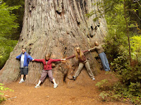
Day Three: On Monday, July 28, it was misty and cool when we got up. We headed up to the Redwood Forest for a look around – the girls didn’t remember much about our trip through there in 1996. We took a small hike through the tall trees, taking time to climb a few and take a bunch of photos (see photo above.) At around lunchtime we left the trees behind and headed north to Oregon. By evening time we got to Diamond Lake Resort where the Nuttall reunion was being held. We were in time for the end of the burger and hotdog fry and chatted with family members until past bedtime. Wow! The mosquitoes and gnats were thick!

Day Four: On Tuesday, July 29, we got up early and hooked up with Meredith and her three youngest boys (Ben, Stephen, and Timothy) and we went over to Crater Lake. We bought tickets for the boat ride and then took a drive around the lake on the rim drive for an hour until our appointed boat time. The boat ride was two hours long – someone mentioned that it was a lot like two hours in sacrament meeting, although I thought that it was at least marginally more interesting. The 1-1/2 mile hike back up out of the crater was tough, but not too tough.

Day Five: On Wednesday morning, July 30, we lounged around the resort for the Family Reunion; Les and the girls participated in the arts and crafts and made themselves visors. Then I did laundry while the girls went kayaking with Ben, while Les, Meredith, and Timmy played on the paddleboats. That afternoon we went out for a two hour jaunt around the lake in a patio boat with cousin Michelle. That was a lot of fun. In the evenings we played cards and chatted with cousins. I spent a lot of time talking politics with aunts, uncles, and cousins.

Day Six: On Thursday, July 31, we got up, packed up the car, checked out of the hotel, and headed south, toward San Francisco. That night, after we checked into the hotel near San Francisco, we drove in to Chinatown, where we walked up and down the streets, had yummy Chinese food for dinner, and then shopped for Chinese souvenirs. On our way back to the hotel we drove up and over the hills of San Francisco, checking out the neat old houses and steep steep roads.

Day Seven: On Friday, August 1, we drove back into San Francisco and spent the morning on Fisherman’s Wharf, checking out the wax museum (Annie’s choice) and a WWII submarine and Liberty Ship. Of course we had seafood for lunch right there on the wharf. Then we took the ferry ride over to Alcatraz Island and toured the prison until they closed the island down – it was fun. Back on the mainland we had seafood again for dinner, visited Ghirardelli Square (the chocolate factory) for ice cream, and then drove on down the coast for a couple of hours.

Day Eight: On Saturday, August 2, we visited the Monterey Bay Aquarium – we went there after the Nuttall reunion in 1996 but the girls didn't remember it either. Anyway, we spent the whole day at the aquarium, until nearly closing time at 8:00PM. The girls were enchanted with the otters and Annie really loved the octopus. That night we drove a ways out of town, to a hotel in King City.

Day Nine: On Sunday (August 3) we got up and drove straight home – it took us about ten or eleven hours, but we made it without any problems. Gas was expensive everywhere we went, so there was considerably less traffic than we might have expected otherwise. Also, unemployment is up over 5% for the first time in a long time, so there are lots of people feeling the money pinch. But now we’re back home, safe and sound, with our photos downloaded and we’ve picked up Dobie from our friends, so we can count this as another successful family trip.

Sunday, July 20, 2008

William Robert Jack Reunion


This weekend Mike and I joined Grandpa and Grandma Jack up in Colorado for the big Jack reunion – I’ve never been to this level of reunion before – it’s for the William Robert Jack family. Robert was my great-grandfather's father - I knew my great-grandpa Jack too. Robert's father, James Jack, was born and raised in Alabama prior to the Civil War (in 1831), where his father, Allen Jack, owned slaves that worked on the family plantation. (Allen Jack’s father, Jeremiah Jack, fought in the Revolutionary War.) James, the 8th son of the family, married the daughter of a puritan, and so didn’t have anything to do with slavery as a matter of principal. In fact, when the Civil War started and his seven older brothers joined up with the Confederacy (most of them as officers,) he joined the Union army with his brothers-in-law. Since he had brothers on the Confederate side, the Union decided not to put him on the shooting lines and they made him a spy. So he adopted the alias “Jack Mayberry” and spied out the Confederate positions and troop movements. Once, as he was swimming back across the river to the Union side with his oldest son Robert (whose reunion this was) on his back to keep the documents high and dry, he was shot in the back, which left him crippled for life. He and his wife and kids joined the Mormon Church after the Civil War, which made him less popular than he already was, and had to emigrate to Manassa, Colorado where the Saints were settling at that time (by then Utah was full.) So, that’s where the family reunion was – near Manassa, Colorado.

Mike was my only traveling companion – our families declined to accompany us (I don’t blame them given the long drive and short stay.) We left early-ish on Thursday morning (July 17) and drove 550 miles, through the Navajo Reservation, Farmington, New Mexico, then through the Apache Reservation at Dulce, up to Chama, Colorado, and then up the Conejos Canyon, along the Conejos River. You would never guess it, but the locals pronounce Conejos as “Kiness” – I didn’t understand them at first and they never did understand me when I’d pronounce the word as in Spanish. Mike and I found the site of the reunion, the Rocky Mountain Lodge, without problem – I’d found it on Google Earth and then programmed the latitude and longitude into my GPS. We arrived just before dark, and so had time to pitch our tent next to our parents’ camp trailer. That evening we had dinner with Grandpa and Grandma and then went and chatted with some new-found relatives around the campfire. I had a chance to meet great-great-aunt Sadie, who is 97-years-old and is the youngest daughter of William Robert Jack, the youngest sister of my great-grandfather. It’s amazing to me – her father saw the Civil War! He was a young man (18-years-old) when he was a Mormon pioneer, migrating from Alabama after the Civil War to settle there in Colorado at the orders of Brigham Young. Talk about spanning the generations! More amazing still, Aunt Sadie walked around camp like she was no more than 60 – what a go-er. I tried to chat with her a bit around the campfire, but she’s kind of hard of hearing (even more so than I am), couldn’t hear exactly what I was saying, and so gave me answers to her best guesses of what I’d asked. So it was a bit discouraging. Even so, it was great to hear some stories that she told.

On Friday morning (July 18) there were no group activities scheduled, so the four of us (Grandpa, Grandma, Mike, and me) loaded up in the car and went down into the San Luis valley itself to visit the old family homesites. We drove to Mannasa first – that’s the center of the Jack’s life in Colorado, founded in part by the Jacks themselves – it’s an old Mormon town, laid out in big square blocks. We started at the cemetery and visited the graves of James Jack (the Civil War veteran and first generation Mormon) and his wife Georgia Ann, the graves of William Robert (James’ son) and his wife Almira, who were the parents of my great-grandfather “Will” and Sadie (who was at this very reunion,) and Ellie, the oldest child of James Jack who died the first winter in Colorado (when she was only 20 years old) – her grave marker states that she was the first white woman to be buried in Colorado. From the cemetery we went up to Jack Street and took our picture with the street sign (see photo above.) From Manassa we drove over hill and dale looking for Los Cerritos – which was the site of an old fort where the Mormon pioneers spent their first winter in tents before founding the town of Manassa the next spring – we finally found it on my GPS (there was nothing left but a couple of houses and the little hills themselves.) Then we went up north a few miles to Safford, where great-great-grandma Almira Jack (Robert’s wife) had had her home. We found the home – it’s ancient and abandoned now, with broken windows and roof-high weeds – I guess time marches on and spares no one or nothing. Then we went out east of Safford across the Conejos (Kiness) River to the “Jack Bend,” another old town-site where the Jacks lived way back when – there’s just a couple of home there, not owned by the Jacks anymore. Then we went up to Alamosa – we wanted to see the Victoria Hotel (where Robert and Almira worked for a while) but it had been torn down not too long ago, we were told. Then we came back to camp via Bountiful, where my Grandpa Jack was born – it’s between Safford and Manassa out on the highway. That evening we had a group activity and played Bingo – there were an assortment of prizes from bags of Oreos for the kids, dishtowels for the in-laws, and copies of old family photos for those interested – your Grandpa Jack won two old photos and I got one.

On Saturday morning (July 19) we got up and took a drive up the Conejos Canyon to the old mining town of Platoro (I’m guessing that they mined gold and silver there.) This trek was significant because my great-great-grandfather Robert Jack both worked on building the road and later spent time working the “Little Annie” mine somewhere in the hills above Platoro. We found the road to be pretty rough, only marginally better than it would have been originally, and the town is all summer cabins now – there’s no real town to speak of. But it was a pretty drive and worth our time. That afternoon a small group gathered to exchange genealogy information, but it turned out that your Grandpa Jack knew more about the Jack history than anyone else present, so we didn’t get any new information. I did, however, get some more photos and family histories from Grandpa. That night we had a big potluck dinner and talent show – the food was good and the talent show was typical.

Then on Sunday morning (July 20) Mike and I got up, struck camp, and spent ten and a half hours driving home. For the last 75 miles, from Kanab to Hurricane, we were in blinding driving rain and had to really slow down for fear of running off the road. Anyway, I’m home again, and it’s bedtime!

Wednesday, July 16, 2008

Yankee Doodle


On Tuesday evening (July 15) straight after work, Robert took us out hiking/canyoneering/rappelling. You know that I love to do that stuff, but I was really worried this particular day because our summer monsoon rains were in full swing (at least, at St. George levels.) Before this past week it’s been hot and clear all month – in the 100-109F range. Then this week it started cooling down (into the upper 90’s) and rained each day. This made Robert want to go up to the canyons and see how they were with water in them. I was worried about flash-flooding – I have at least two cousins that I know of who were killed in flashfloods, along with their Boy Scout troops, in the canyons in Zion. Anyway, we didn’t want to "just say no” so we agreed to go at least as far as the edge of the canyon and then see if it was raining or not. There were six of us: Robert and Kelton, Les and Me, Seth, and Kyle. (Kyle’s dad had given him a lecture about flashflooding in slot canyons.) So we drove up to Leeds, then through Silver Reef, and up past the turn off to Oak Grove, to a nifty little slot that Robert had been shown by his brother Larry. The boys called it "Yankee Doodle" but I don't know if that's really its name or not. Anyway, when we got there the skies were largely clear – it was cloudy to the south – but it was certainly not raining at the moment. So we put on our harnesses, grabbed a couple of ropes, and hit the trail. The first rappel was dry, then we had a bit of bouldering, and then we hit the water. We had a couple of rappels into waist deep pools, but after unhooking from the rope we had to swim across a pool of water that was over our heads. The water was actually pretty warm, I guess because it was still pretty fresh (Robert had taken Kate through the same canyon a week before and it had been bone-dry.) I’ve got to say that I found that my bouldering was much smoother than in the past – I can tell that my upper body strength has increased considerably since I started lifting weights three mornings a week back in May. The climb back up out of the canyon was a bit spooky – we scaled this cliff, breaking out the ropes only twice. All told it was a 70-minute climb down through the slot canyon and then a 40-minute climb back out. Of course, there was an hour-long drive in and out, so we got home after 9:00 that night. But we did get home all safe and sound; the rain stayed away and in fact the temperatures were perfect – warm enough to enjoy the water but cool enough to enjoy the hike. I’d rate the hike somewhere around the level of Keyhole.

Saturday, July 05, 2008

A Week in Paradise


After church on Sunday, June 29th, we loaded up Robert’s pickup with our bags that we had packed the day before, and we hit the road for Kingman. Our traveling group consisted of Robert, Kody, Katie, Leslie, and me. The three from our family just had four bags: three duffels, each weighing the regulation 32#, which contained our tent, sleeping pads, sheets, fleece blankets (it was too hot for sleeping bags), and clothes for down in the canyon; our fourth bag contained our clean clothes for our two nights in the hotel in Kingman. Oh, and we also had a camelback each, for our water, hiking snacks, and other incidental stuff that we might want before the mule train arrived at camp. We made the trip to Kingman in the standard four hours and checked in to our hotel without any problems.

We got up at 3:45AM on Monday morning, grabbed a fast shower, got dressed, iced up our camelbacks, loaded our bags into Robert’s pickup and then followed our host, Dave, to the trailhead on the Havasupai reservation (about 120 miles from Kingman.) Dave is a local businessman who dabbles in many things, including land development and farming, and has been successful enough that he travels a lot and often invites family, friends, and friends of friends, whoever wants to come along, to come along with him (at our own expense, of course.) The first 60 miles out to the reservation was on Route 66, passing through Truxston, which I swear was featured in the Pixar movie “Cars.” We got to the trailhead at 7:00AM and stacked our duffels in a big pile with the rest of our group – there were around 130 of us all together – from which the mule train was going to load them up after we’d departed. After lathering ourselves with sunscreen we hit the trail; Kody took off like a shot, with Robert and Katie right behind, and Les and I took a more conservative pace (although we outpaced most of the rest of the party.) The trail starts off with some really steep switchbacks that take you down about 1000 feet over the first 1.5 miles into the canyon, and then you start walking down a more gradual slope through this long windy canyon, with alternating sandy and gravel floors. Since it was all downhill I wore my knee braces and used my hiking sticks and actually made the whole ten miles without too much arthritis knee pain. At Dave’s recommendation we stopped about halfway down the trail and changed into dry socks and put some moleskin on the spots developing blisters (Dave recommended duct tape;) I was getting blisters on the same spot where I’d given myself blisters walking across Coronado Island in San Diego a month ago. At 6-miles we hit the start of the river and trees and the walk became pretty pleasant and shady. At 8-miles we hit the Havasupai Indian village; it had (in order): dusty streets, a little store, an LDS church, a few houses, a tourist office, a helicopter ride office, a helicopter landing pad, a Post Office, a bigger store, a café, a school, a Protestant Church, and a lodge. We bought some cold drinks at the main store and looked for lunch at the café, but it was only 10:00AM and they were only serving breakfast, so we headed on down to the campground.

At the campground, 2 miles down from the village, you first hit the hitching posts where the mules drop off your bags, a cluster of port-a-potties, and then a string of campsites about a mile long. The campground was sprinkled with picnic benches and had one spigot of fresh water coming right out of the sandstone cliff (sandstone is a very good water filter.) When Les and I arrived, Katie, Robert, and Kody had already picked a fine camping spot near a shady tree. So we piled our bags on our picnic table, changed into our swim suits, and headed back up the trail about ¼ mile and visited the Havasu Falls. If you’ve seen a photo of the waterfalls in Havasupai, it was probably of Havasu Falls. It falls about 100 feet into a pool of blue-green-turquoise water – apparently the color comes from the lime in the water. What’s really neat is that the high content of lime in the water causes it to stick to all of the tree roots and rocks that it passes over, forming these beautiful organic limestone dams, which create a whole series of pools and little waterfalls cascading down the hills after each waterfall. After cooling ourselves off in the water for a couple of hours, we could see the dust from the muletrain going by (yes, I sang the Frankie Laine song the whole week), so we headed back to the campground to retrieve our bags, pitch our tents, and set up camp. That evening Dave served a wonderful dinner of pork chops, corn, green salad, and rolls with either lemonade or Tang to drink. He had this brilliant system where he’d cooked the meat in advance, then sealed it in these vacuum packs that he froze and then just had to boil to reheat, and the meat came out tasting like it was fresh off the grill. There was an attempt at a fireside/sing-along that evening, but there were very few willing participants so we just headed off to our tents to call it a night. I’ve got to say, it was very hot and sweaty in our tent and it took a very long time to fall asleep laying there on the hard ground. Finally, at what time I don’t know, it cooled down a bit and we slept the rest of the night away.

On Tuesday morning we got up with the sun (which doesn’t come very early down in the canyon) and helped prepare breakfast – they were cooking pancakes, bacon, eggs, and hashbrowns and I just had to help flip the hotcakes (it's a compulsion of mine.) After breakfast the bulk of the group headed downstream about a mile to Mooney Falls. The trail was very easy, just winding through the campground until you get to this 200-foot cliff, where the trail got really fun – we got to climb down through a couple of tunnels and then scramble down the cliff face hanging on to chains and toe holds and ancient rickey wooden ladders. Our climbing experience here in Zion and Snow Canyon made this a breeze for us, but some folks really struggled with the challenge. Down at the bottom we played in the pools below Mooney Falls, which falls the whole 200 feet, with the turquoise water and cascading pools like up at Havasu Falls. Here there was a rope swing that most everyone had to try out (not me.) Some of our better swimmers (including Katie and Les) swam out to the waterfall and climbed up the rocks beside it and jumped about ten feet into the water. We headed back to camp in time for lunch – they served cold sandwich meat on flour tortillas – it was yummy. After lunch we headed about ½ mile upstream to Navajo Falls, which I thought was the most beautiful of all. Navajo is only about 75 feet tall, but it was very wide and instead of one thin stream it fell over a series of drops, looking very much like a bride’s veil. Best of all, this fall had a lot of nooks, crannies, and grottos around its edges, making it very fun to explore. And of course, Les and Katie had to climb up about 10 feet and jump in to the water. After exploring the face of the falls, Robert led us up the backside of the falls, using this little side waterfall as our ladder – it wasn’t slippery as you’d expect due to the lime in the water making all surfaces very grippy – we went all the way up to the top of the falls and soaked for a while in the pools up there. (The attached photo is of one of the grottos and pools up above Navajo Falls.) That evening we had grilled chicken breasts, green beans with almonds, green salad, and rolls for dinner. After dinner a group of us got together and played cards and “Catch Phrase” until it was too dark to see.

On Wednesday we decided to forgo the long hike down to Beaver Falls, which are five miles downstream from camp and aren’t that spectacular – after all, who needs a ten mile hike the day before we were scheduled to make our ten mile hike out of the canyon? So we spent the morning at Mooney Falls again – the climb down into the canyon really makes that little trip fun. After chili-cheese dogs for lunch, we headed back up to Navajo Falls, where Leslie and Katie decided to challenge themselves and jump in from an even higher rock – probably 20 feet high or so. Then we decided to climb the waterfall-ladder again, and went up even higher than the day before. Back at camp we found that the number of injured from our party had risen to three – people who had seriously hurt themselves jumping into the pools and hitting rocks – they were going to have to helicopter out the next day – both Katie and Leslie had grazed themselves on rocks while jumping into the pools, but were still fit for hiking. For dinner that night we carbo-loaded with a lovely spaghetti dinner, after which we amused ourselves playing cards until it was too dark to see.

On Thursday morning we had our standard pancakes, eggs, bacon, and hashbrowns for breakfast before we struck camp and packed up everything into our duffels for the mules to carry out. Then we killed a few hours in the water at Havasu Falls – we didn’t want to hike out in the heat of the day. A little after noon we changed into our dry hiking clothes and headed back up the trail the two miles to the village – that little jaunt was really hot and miserable. So we shaded up at the little café there in the village and had lunch and copious amounts of Gatorade. When it got to be 2:00PM we bought some frozen Gatorades for the trail, iced up our camelbacks, and hit the road. We were just going up to the end of the river, another two miles upstream from the village, to stay cool until it got later in the day so we’d have shade while hiking through the canyons, but suddenly an unexpected cloud came up and so we just kept on going. It turned out that we were shaded by those blessed clouds all the way out until we hit the final switchbacks on the final mile or two – it was really pleasant. The last drag up the hill was brutal in the full sunshine, but we managed to make it, draining the last water from our camelbacks and killing our now melted Gatorades. In the end, we were some of the first to make it out of the canyon, at 6:30PM, but about two hours behind Robert and Kody, who had the pickup all loaded with our bags and ready to go. At the parking lot Dave, our host, had one of his sons waiting with frosty/slushy orange juice, which felt really good on our dry parched throats. From there it was a quick two hours’ drive back to the hotel in Kingman – we were all too tired to want dinner so we just showered and called it a day.

On Friday, the 4th of July, we got up, showered, loaded the pickup and headed home. It’s just four hours on the roads between Kingman and St. George. At home we found Annie and Dobie safe and sound – so we can count this as another successful family trip. Here at home we unpacked and put away the camping gear. We grilled hamburgers to celebrate the 4th of July and watched the movie “Independence Day” (with Will Smith.) We drove uptown that night to watch the fireworks at 10:00PM – they were as spectacular as usual. And that completed our week in paradise. I've posted our photos on-line - let me know if you want me to send you an invitation to view them.

Saturday, June 21, 2008

Willis Family Reunion


This morning Kate and I went to Toquerville to the Joshua Thomas Willis Family reunion. Joshua Thomas Willis was my 3rd-great-grandfather – grandfather to Clara Rogers Jack, my great-grandmother. We met for the reunion at the town park there in Toquerville from 9AM to noon. There were about 30-40 people there, representing four different children of Joshua’s 16 children by his first wife – there were no representatives from his children by his other two wives. Our family line came through his #10 child, Lovina Lucinda Willis, who married Joseph Rogers, who was living in Fillmore but was down in Dixie to work on the St. George temple. Our family’s report was given by my dad's cousin, Colleen – she gave a very touching life story of Lovina Lucinda and there weren’t a lot of dry eyes when she finished. It was a lot of fun to hear all of the family stories that were shared. I bought one of the few copies of a book that the reunion organizer had available to sell, titled: When You Know Your Past, You Understand Yourself: The Joshua Thomas Willis Story.

Some interesting things that we learned about Joshua T. Willis was that he was the Founder and 1st Bishop and sheriff of Toquerville, and that he’s the one who started cotton and silk production in Dixie and that he’s the one who dubbed the area “Dixie.” After the family meeting, Kat and I drove down to the cemetery to see the new headstone for the family burial plot - the photo I've placed up top is of the headstone – up until recently there were no grave markers for the Willis Family. Then we went to the old family homestead site – it’s now occupied by a fancy bed & breakfast that hosts wedding receptions – in fact, our friends hosted their son’s wedding reception there, so I’ve been inside. All in all, it was really great to get acquainted with a few more ancestors that we hadn’t known before.

Tuesday, June 17, 2008

Kannaraville Canyon


On Monday, June 16, we took our guests, Paul and Jane and kids, and hiked Kannaraville Canyon. It was lots of fun. The town and adjacent canyon are just a half hour drive up the freeway from here, the last few miles over a dirt road up to the mouth of the canyon. This gorgeous little slot canyon is an easy hike, just a couple of miles each way, and is a great intro to slot canyons. You mostly walk along a path that crosses the creek several times. Once in the canyon itself you have to scale a slippery log to continue on the upper half of the hike. At the end of the hike you have to climb a rope ladder in the falling water to get up to the highest level before leaving the slot. Between the two little climbs there is a natural pool that you can slide into on the wet slippery sandstone. Little cousin Sarah said that it was “the funnest thing ever – like a water park, but better!” Aunt Jane admitted that she was a "little freaked out" by having to climb the first waterfall via the old slippery, squeaky log – but she (and all the rest of us) went up and down without a hitch and declared the trip a success. I’m attaching a photo of our most intrepid hikers who even braved the wet rope ladder and scaled the last waterfall. The only problem with the day was that baby Becky Lou came out with Les’s cough and cold (which Les got from me), just in time for them to head off to Disneyland on Tuesday morning.

Saturday, June 07, 2008

Observation Point


Saturday morning, June 7, Les, Kat, and I got up at our regular 5AM so we could go hiking with Robert in Zion Canyon. We did the Observation Point hike. It’s 8 miles round trip, with a rise of 2150 feet from the floor of the canyon to the overlook, where we could overlook Angel’s Landing (which is 1500 feet above the floor of the canyon.) I was feeling about 90% well, with just a bit of my cough left, so I wanted to test my mettle and see if I could actually do a good long hike (we’re trying to get in shape to hike to Havasupai at the end of this month.) I did OK, just huffing and puffing, chugging along at the back of our little group (Kat took the lead spot.) But my arthritic knees had me going slow enough on the downhill half of the hike that Mom, Kat, and Robert did another side hike to Hidden Canyon without me (probably another mile or so each way.) We were early enough in our departure time that it was nice and shady as we hiked up the hill and we didn’t pass any other hikers until we were on our way down – then we passed hikers going up all the way down. I got to the bottom first, having bypassed the Hidden Canyon side trip, and waited about an hour for them before they arrived. I’m attaching a photo from our hike, taken up at Observation Point – Angel’s Landing is down just over Kat’s right shoulder.

Wednesday, May 07, 2008

For the first time in my life, I am ashamed of US


From 2002-2006 we lived in La Paz, the capital of Bolivia, although I frequently worked down in Santa Cruz. The power company in Santa Cruz, CRE, is the world's largest electric cooperative and was founded with the help of my former employer back in 1962.

This current political problem in Bolivia has been very complicated from the beginning; Bolivia has been mired in poverty in spite of their abundant natural resources largely due to government mismanagement. One of their worst setbacks happened in the 50's when their communist government broke up all of the large successful farms in the country and gave out little parcels to the poor workers - "land reform" it was called. It turned out that all of the little mismanaged farms couldn't produce the food that the few well managed big farms could, so Bolivia lost their food independence almost overnight. So then the farmers who had formerly owned big farms, which had all been confiscated by the government, bought up big tracts of land down in the Amazon basin and made new farms in what is now the state of Santa Cruz. Their new big farms are what currently feed the whole country and are what the new communist government wants to confiscate and break up into little farms and redistribute to all of the poor Indians who can't make a living on the little farms that their fathers got back in the 50's. Obviously these big prosperous farmers don't want their property confiscated again.

To make matters worse and even more volatile, EVERYONE in the country knows that the current president, Evo Morales, was put in place by Hugo Chavez in his bid to unite all of South America under one communist government ruled by himself, the reincarnation of Simon Bolivar. Evo, just like his daddy Hugo, and his granddaddy Fidel is doing everything he can to make himself dictator for life over Bolivia. The "rebels" down in Santa Cruz are doing everything they can to protect themselves from him. While we were living in Bolivia, Santa Cruz even appealed to Brazil to annex them away from Bolivia. I don't blame them. If I lived in Santa Cruz I would be taking up arms in defense of my property too.

By the way, I see the events in Bolivia as the road map for the path on which the US is currently traveling. When Barack Hussein Obama is our president, I look for our government to implement all of the same "progressive" reforms that Evo, Hugo, and Fidel have implemented. And then we'll see what has to happen to preserve our life, liberty, and pursuit of happiness.

The communist experiment in the Soviet Union was a spectacular and well-documented failure, as were all of those in China, Cuba, Nicaragua, Chile, Bolivia, Peru, practically all of Africa, etc. etc. And YET... we currently have "democratically elected" socialist (= communist) governments in Argentina, Brazil, Chile, Bolivia, Venezuela, Russia, Ecuador, Nicaragua, Spain, and nearly all of Western Europe. Did no one in any of those countries ever read anything about history?!

And even worse - all three of the candidates to be president of the United States are avowed socialists! They are all promising us (due to popular demand) socialized medicine, socialized retirements, socialized housing, socialized utilities, socialized transportation, etc. etc. How is that even possible? How ignorant are we? I am more ashamed of us as a people, for our ignorance, than Michele Obama ever thought of being. We are NOT the America that the world thought we were; this is not the America that our grandparents endowed us with.

Monday, May 05, 2008

Arches National Park


We’ve just returned home from a weekend (May 2-4, 2008) with the Hansens at Arches National Park over in Moab, Utah. We’ve been meaning to go over there for years, and we finally made it. We left after school and work on Friday afternoon – the drive is about 333 miles each way – so we didn’t arrive in Moab until about 10:30 at night. We stayed at the Super-8 motel, so it was nothing fancy, but it was a fine place to sleep, especially since the town was booked up with various events.

We got up dark and early on Saturday morning, had the continental breakfast at the motel (juice, donuts, and granola) and headed over to the park. Even though the sky was clear and sunny, the day was relatively cool; with our wet cool spring this year there were wildflowers in bloom all over the place. In the park we made a whirlwind pass through all of the premier sites, starting with the overlook of Park Avenue, a little trail named after the towering skyscrapers in Manhattan. At the other end of the Park Avenue trail we stopped and took a photo of some rock climbers scaling one of those giant red cliffs. Then we drove up the road a bit – of course, I made Robert stop every mile or so to take photos of this amazing place, with its myriad arches, starter arches, fallen arches, impossible rock towers, and “Petrified Dunes” – to the Balanced Rock, which looked a bit like a giant natural Moai (from Easter Island;) we took the walking path all the way around the rock – it’s only 0.3 miles.

Just beyond the Balanced Rock we turned off, drove past the Garden of Eden, and parked at the Windows Section. We took the 1-mile trail over to see the Turret Arch and the North and South Windows; I don’t know the difference between an arch or a window, but they were all very cool to see. From there we took the short drive over to the next stop, and took the 1-mile hike up into the Double Arch, with two giant arches joined at one end (like a “Y”.) There are a couple of caves next to the Double Arch that we hiked up to also – they were cool looking, but not much to see inside. From our perch up in the Double Arch, looking north, we could see what was called the Cove of Arches, with several other smaller arches – there were arches everywhere we looked. In fact, there are 2000 documented arches in the park, and I don’t suppose we saw more than about 1% of them.

From there we drove over to the Delicate Arch viewpoints (Delicate Arch is the one on our license plates) – the lower viewpoint just 100 yards from the parking lot, and the upper viewpoint about ¼-mile hike up the hill from the parking lot, where you can see the arch beautifully silhouetted across the canyon. We saved the hike over to the Delicate Arch itself for the next day. On our way back out to the main road we passed the Pot Hole Arch – an arch that’s oriented like a basketball hoop.

Then we drove up to the end of the road, to the Devil’s Garden, a 7.5 mile walk that starts off by threading between these huge red sandstone towers. The first stops, not far up the trail, are the Pine Tree Arch (so named because it has a Juniper Pine tree growing in it) and the Tunnel Arch (kind of a double arch, which is thick like a tunnel.) A little further down the trail you see these huge red sandstone elephant heads, like elephants on parade in a petrified circus. Then comes the huge and much photographed Landscape Arch – impossibly thin as it spans over 300 feet from base to base. You can’t get too close to the Landscape Arch since a huge chunk fell out of it a few years ago, so now they have it fenced off, in case the rest of it decides to come raining down. Here we found a nice patch of shade, backed up against a large cliff-face and had our lunch. Then, right on the path a little further along, we came to Wall Arch – it’s like an arch in a large stone wall. Further along the path there are two spur trails; we took the left one first, to Partition Arch, a double arch, from which you can see down on the main trail. The second spur (back to the fork in the road and then to the right) led us to Navajo Arch; this arch is halfway buried in the sand. Then we hiked on top of a little 5-foot-wide backbone of sandstone (with some tourists behind us crawling on their hands and knees) until we came to the Black Arch, so named because it’s silhouetted against a black wall of sandstone behind it. Around the corner (and over hill and dale) from there we found the Double-O Arch, which could just as easily be called the Figure-8 Arch since the two arches were stacked vertically rather than horizontal from each other. There were some crazy guys walking along the top of the top arch – very much against the rules. From there you can either return the way you came, which is the most common choice, or take the scenic route called the “primitive loop” which takes you down below all of the rocks over which you’ve scrambled to get this far. On a little spur trail off of the Primitive Loop, there is the Private Arch, which is the only arch on the return via the primitive loop.

All told we hiked around 10 miles that day, which was plenty for my poor knees – about my limit for one day. I’m glad we went early in the day – not only was it cool, but the crowds all seemed to be behind us. There were lots of people still pulling in to the park as we were leaving. When we’d done all of the hiking and site-seeing that we could for the day, we headed back to Moab and the hotel where we spent about an hour in the hot tub soaking the kinks out of our sore muscles. That evening we went to a casual steak house for Annie’s birthday dinner (although her birthday was really on the 4th.)

On the morning of the 4th, we got up dark and early again, and headed back to the park for a couple more quick sites. First I dropped Robert, Kody, and Leslie off at the Park Avenue Trailhead and picked them up at the bottom of the hill (about one mile later.) Leslie said that the hike was through these huge tall rocks that looked like the skyscrapers of Manhattan (hence the name “Park Avenue.”) While they were hiking I took some photos of Fallen Arch, which is now some big rocks where they surmise had been an arch or two but have since fallen down. Then we hiked over to Delicate Arch and passed two other less-famous arches along the way. It was a three mile round trip hike of mostly up on the way there and then mostly down on the way back – I huffed and puffed all of the way up (it’s a good thing I work out every morning) and then winced at my arthritic knees (still sore from the day before) all of the way down. Since it was early we practically had the place to ourselves – it was great. We took pictures of the arch, in front of the arch, under the arch (see photo above), and even risked the steep slickrock on the backside to take pictures behind the arch. On our way back to the car we took a little detour to see some petroglyphs of Indians on horses, with dogs, chasing Bighorn Sheep – they were cool.

All told I took nearly 200 photos. We passed a whole bunch of tour buses arriving in the park as we were on our way out – perfect timing for us. After checking out of the hotel, the Hansens decided to head straight home, but we decided to have Annie’s birthday brunch at Denny’s right next to the motel before driving home. From there we drove straight home and thankfully, although I got really sleepy, the drive was uneventful. Here at home we found everything in order, so we can count this as another successful vacation trip.

Sunday, March 16, 2008

Cancun Spring Break 2008


We spent our Spring Break week of 2008 in Cancun, Mexico, and here’s a blow-by-blow of our adventure:

Vacation prep started well in advance of the actual trip, back in January. It started by picking a destination – we chose Cancun this year because our buddies, the Hansens, have been several times and really wanted to go together this year; it sounded like fun, so we started shopping trips. Our shopping consisted of surfing different options on the internet, starting at Travel Zoo (at: http://www.travelzoo.com/,) which led us to Book It (at: http://www.bookit.com/,) which led to a pretty great deal on an eight day/seven night stay at the Marriot Casa Magna with airfare from Frontier Airlines.

So, on Saturday, March 8th, we got up at 2:00AM, after a brief night’s nap, got showered, loaded up the car (having packed the night before,) and headed out to the airport in Las Vegas. We flew Frontier airlines – I think it was my first time with them – the flights were just fine, but the check in at the ticket counter was painfully slow. We were traveling with the Hansens but it turned out that they were actually on the 7:00AM flight instead of the 6:00AM flight with us, which we only figured out after we both had our boarding passes. Oops. There was a bit of a snafu with the gate assignments, but at the third gate to which we were sent we actually found our flight all ready to board. We had a brief and thankfully uneventful layover in Denver, Frontier’s major hub. In Cancun we cleared immigration after a loooong line, reminiscent of Miami (hint: go to the line all the way to the right, in both places), found our bags, and passed through customs with a green light. Whew! Outside of customs we were accosted by helpful “tourist information” agents who were really touts for timeshare hotels – we only wasted a minute on them before excusing ourselves. The transfer to the hotel via Best Day tours, which we’d paid for through the Book It website, was at the far end of the hotel bus area, but we found them without any problems and they took us to our hotel in short order. We found that Cancun was pretty busy that week, but not as bad as it would have been next week when the rest of the world takes their Spring Break. As I mentioned before, we stayed at the Marriott Casa Magna, which is a five star hotel/resort out on the “hotel zone,” a narrow strip of beach between the sea and a lagoon, just east off of downtown Cancun. Two hours after we checked in to our hotel and got settled in to our room, the Hansens caught up to us there at the hotel in Cancun. By then it was so late that we barely managed dinner at the “La Shrimp Bucket” across the street from the hotel (fairly nice place, but with small portions and very expensive) and a walk up and down the beach outside our hotel’s back door before dropping dead in bed after a 22-hour long day.

On the 9th we slept in as late as we could, which turned out not to be very late after all. We got ready for the day, grabbed a McDonald’s breakfast across the street (the hotel wanted $20 each for the breakfast buffet), and headed into the center of town to “Mercado 28” where they have the arts and crafts market. While the rest of us shopped souvenirs, Katie and Kinsey got their hair braided. We ate lunch at a little almuerzo booth at the market there – it was yummy. We didn’t end up buying very many souvenirs because the prices there in Mexico, at the heart of the American tourist zone, were so high (at least compared to prices in Bolivia, Bangladesh, and India.) Then we walked around the downtown for a bit, while Robert and Palma reminisced about their adventures as refugees during Hurricane Wilma two years ago – we even visited the hotel where they hunkered down for a week while the storm raged all around them. From there we walked over to Wal-Mart where we bought groceries for our breakfasts for the coming week. That night we actually ate dinner at the hotel restaurant and used up the $100 food voucher that came with our airline/hotel package deal - $100 doesn’t buy much at the Marriott and if we were to do it over again I’d have just gotten the all-you-can-eat salad bar which seemed to be the best value for the buck.

On the 10th we got up and headed straight for the beach, where we spent the whole live-long day. It was a little cloudy, pretty windy, and the sea was very rough, so the hotel was flying their “red flag” which means “no swimming.” So we amused ourselves by finding and collecting interesting sea shells as they washed up on the shore. You had to spot and grab them quickly, before they washed back out with the same wave that had brought them in. We found a lovely selection of shells that are now displayed in our living room (come over and check them out.) That night we caught the local bus and went back downtown for dinner – we ate at the “La Parilla”, a Mexican Grill, and had a very yummy dinner. We all ordered something different and then traded tastes – everything was good.

On the 11th we got up early and took a tour bus to Xcaret, the eco-Disneyland of Mexico. Xcaret is really a Mayan archeological site with a lot of extra attractions built around them. We bought our Xcaret ticket and transportation package deal for $107 each at the little ticket booth at Mercado 28 – Best Day tours wanted $150 each for the same package deal. We opted to start the day with a swim through the underground river – included in our package deal – the whole Yucatan peninsula is a honeycomb of underground rivers. Then we caught a boat out to the barrier reef (second only to the “great” barrier reef off Australia) where the four of us did “snuba”, which is like SCUBA diving except that the air tanks aren’t strapped to your back, they float on a raft on the surface and you have a 20-foot long air hose which both limits your depth and gives you a tether to the surface. So, instead of needing a week to get certified you can go diving with about five minutes of training. While we were under the water we saw an octopus, a 5-foot barracuda, and a couple of sea turtles, as well as lots of little colorful fish and coral. It was well worth the extra $50 each for the significantly enhanced experience. Then we went back to the beach and did a little snorkeling, but it just wasn’t that thrilling after the snuba adventure. Then we wandered around the park, checking out the butterfly garden, the jaguars, manatees, dolphins, and the Mayan village (where they did this whole big ceremony production.) That evening we went to their two-hour cultural show, where they demonstrated the ancient Mayan ballgame, as well as songs and dances from all the states of Mexico – it was really well done.

On the 12th we had another lazy day at the beach, lounging in the sun and shade and collecting sea shells – it was luxurious. That night we went back into the center of town for another round at La Parilla and a few more groceries at Wal-Mart.

On the morning of the 13th we hooked up with Helaman Tours (our bishop recommended him after taking his tour of Tulum from his Caribbean cruise back in January) and headed out into the jungle to see the ruins at Chichén Itzá and Ek Balam. The attached photo is our little group of eight in front of the pyramid at Chichén Itzá. The ruins were great and Helaman gave us an LDS oriented tour, pointing out all of the things that you’d only understand if you considered the Mayans in the context of the Book of Mormon (bearded white god, crucifix, horses, elephants, paved roads, broken hearts, Solomon’s temple, LDS temple signs and symbols, etc.) – it was really great. Chichen Itza was every bit as spectacular as the photos show (although it’s disappointing that you can’t go inside the great pyramid anymore, nor can you climb them.) The real highlight for me, however, was the newly excavated ruins at Ek Balam. There we not only got to climb the big pyramid/temple, but they also had some terracotta figures and painted plaster walls that were amazing. Helaman gave us a really great deal – just $300/day for each family of four, which included transportation, food, water, and park admissions. (See: http://www.helamantours.com/.)

We had Helaman take us out again on the 14th to see the ruins at Cobá and Tulum, some more great ruins. Cobá is the ruin complex where they found the Mayan calendar that ends in the year 2012. Also on the 14th we got to go swimming in a cenote, one of those limestone sinkholes that are filled with water and connected to all of the underground rivers. The cavern came complete with stalactites on the ceiling and the water was so clear that you could see the bottom even though it was too deep to reach even when Leslie (our best swimmer) dived down to try and touch it. We also went swimming on the beach at Tulum since it was our last day in Cancun and the first day that we could swim in the ocean – it was very lovely. I was so impressed with the things we saw on our LDS version of the ruins tour that, while it’s still fresh in my mind, I’ve made a PowerPoint presentation of my photos along with the scriptural references in case I’m ever asked to give a lesson or fireside on the subject.

Then, alas and alak, Spring Break ground to a halt and on the 15th it was up at 3:00AM, after a brief night’s nap, and we flew back home. We arrived here at home all safe and sound and we found everything shipshape (no robbery, no broken pipes, etc.) so we can count this as another successful family vacation trip.

Tuesday, March 04, 2008

Why I'm Opposed to Universal Health Care


The following exchange is extracted from an e-mail discussion with a friend of mine who is in favor of Universal Health Care, as proposed by all of the current presidential candidates. I broadcast this because I'm shocked and appalled at how willingly we, as a country, are willing to abandon the free market system that has made this country prosperous and are embracing the socialist system that has been exposed as a flaming failure in every instance, including in the former Soviet Union, Cuba, North Korea, and all over Latin America, Asia, and Africa.

My friend wrote: "On universal health care you did not look at the successes of Canada, Sweden, France or Great Britain.....which has free health care, and some private you pay for doctors on the side. The people I know from Canada love their system and do not understand when American politicans attack their system. I have been told by Americans who have traveled in France that the health care is free even for tourist that the state takes care of everything. As for Cuba from what I have read their health care is one of the bests at least for the average Cuban. I do know the Soviet system was a total failure and you would know better about Boliva (however an American teacher here whose wife is from Boliva and they have a "large" home there and claims that all of his dentist work is extremely good but cheap. So I do not know what to say)."

To which I responded: "My uncle, from Canada, is the one who told me that Canada's health care system is "broken". He sent me the following link to a short video that details some of its shortcomings: http://www.freemarketcure.com/brainsurgery.php. In case you don't have time to watch it, what the video explains is that the healthcare system in Canada is overloaded to the point that people are dying while waiting in the queue for their turn to get required surgery from the overloaded but underfunded medical centers and so are coming to the US to buy their life-saving surgeries. I've read similar articles on CNN.com about the health care system in England as well.

And according to my many Bolivian friends who have been to, worked in, or were educated in Cuba, their healthcare system is horrific, the fictional movie "Sicko" notwithstanding. One Bolivian friend sent me the attached PowerPoint file with photos from Cuba's hospitals. They're truly nasty. (Sorry, it's not attached to this posting - let me know if you want me to send it to you - or you can check out some facts on the following website: www.therealcuba.com. In fact, the attached photo of one of Cuba's premier hospitals is from that website.)

As for Bolivia's healthcare system, it's two-tiered. There are the "free", public clinics that will remind you of those on the reservation (as I knew them in the 70's - maybe they've improved.) Anyway, in Bolivia they're really bad. BUT, for those of us who were relatively wealthy, we could afford to visit the very best private doctors in the country for a very reasonable fee and on very short notice. I remember taking my kids to the dermatologist - he was US trained, spoke English, was located right in my neighborhood, had all the latest equipment, and when I called for an appointment the receptionist told me that if it was an emergency we could get in that same day but otherwise we would have to wait a day or two (compared to here in the States where an emergency might get you in to the doctor that week, otherwise it'll be months away.) Anyway, for the $25 fee, we got the office visit, a couple of follow-up visits, and some medicine. It was great. But, you have to be "rich" in Bolivia to afford a $25 doctor bill. We had similar experiences with the dentist and pediatrician in our neighborhood too.

So, given what I've observed and read, I wouldn't trade our current free-market system with ANYONE in the whole world, certainly not anywhere in Latin America, Africa, or Asia, AND I wouldn't trade places with anyone in Europe. I haven't seen anything in my travels in Europe that I'd like to emulate in our country.

And I certainly don't think that the government should steal money out of my and my kids' pockets to pay for healthcare for all of the former juvenile delinquents who were too cool for school and chose not to study and work to enter a career that includes health insurance.

Further, given the (lack of) quality at the VA hospitals, I certainly don't want the government to provide me health care. If they can't take care of our veterans, they certainly won't take care of me or my kids.

So... feel free to enlighten me if you think I've gotten any of my facts incorrect.